Satellite imagery is priced and sold on axes that rarely match how buyers first think about it. "We want the best possible pictures of our sites" turns into a quote that varies by orders of magnitude depending on answers the buyer did not know they were giving. These five questions, asked in order, scope the purchase — and often shrink it.
1. What do you actually need to see?
Spatial resolution (ground sample distance) is the biggest price lever. The working rule of thumb: you can detect an object a few pixels across, but you need many pixels across it to identify it. Counting buildings after a storm, monitoring vegetation over thousands of hectares, and reading roof damage on a single warehouse are three different resolution classes. Commercial very-high-resolution satellites sell imagery in the tens-of-centimetres class; be honest about whether the task needs that, because the next question is often the cheaper answer.
2. Is free imagery already enough?
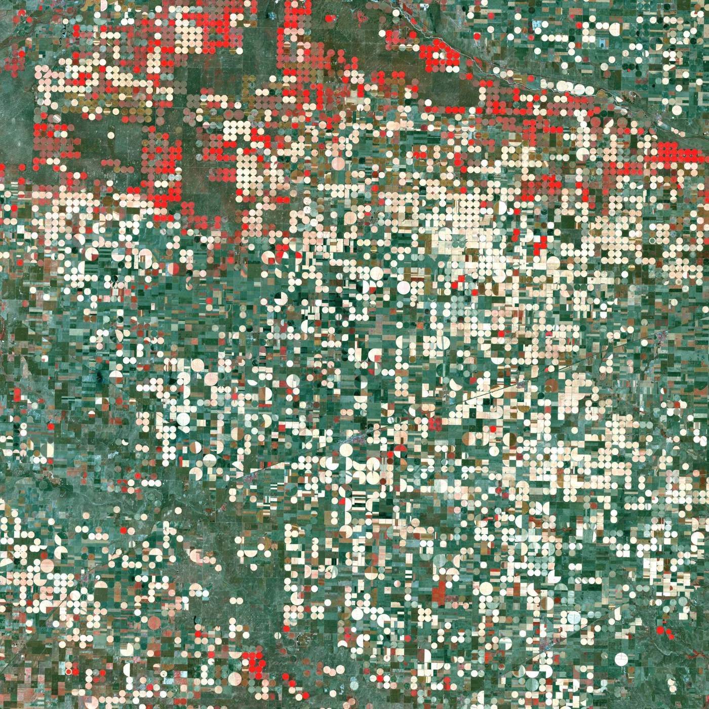
Two public programs cover the entire land surface, for free, with full archives: Landsat (NASA/USGS, imaging since 1972; today's satellites deliver 30 m multispectral with a 15 m panchromatic band, though resolution was coarser on the earliest missions) and Sentinel-2 (the EU's Copernicus program, 10 m in its visible and near-infrared bands, revisiting every few days). At 10-30 m you will not count cars, but a huge share of real monitoring work — vegetation condition, water extent, land-use change, burn scars — lives comfortably at those resolutions. Always price the free option first: the featured image on this post is free Landsat data.
3. Archive or tasking?
Buying from the archive means the picture already exists: you search a catalog, check the cloud cover, and know exactly what you are getting. Tasking means paying a satellite operator to collect your site in a future window; it costs more, and weather or collection priorities can push the date. If the question is "what did this look like last June?", the archive is the only option anyway. If it is "watch this site every week from now on", compare the tasking contract against monitoring with free constellations plus occasional high-resolution buys.
4. Which bands, and how processed?
Beyond the visible, near-infrared separates healthy from stressed vegetation (the red circles in the image above are irrigated crops in false colour), shortwave infrared helps with moisture and burn mapping, and thermal bands read surface temperature. Ask what the analysis needs, not what looks nicest. Then ask what processing level you are buying: orthorectified imagery aligns to the map; surface-reflectance products correct for the atmosphere so scenes from different dates compare honestly. "Analysis-ready" pixels cost less than an analyst's week spent making them so.
5. What does the licence let you do?
Commercial imagery is almost always licensed, not owned. Licences commonly restrict how many people or organizations may use the pixels, whether you can publish them, and what happens to derived products — though maps and analysis results you create are typically yours. Public-program data (Landsat, Sentinel) carries open licences suitable for publication. Read the terms before the purchase, not when the report is due at a partner organization.
Scoping questions like these are the first conversation of an imagery project, and getting them right is cheaper than a wrong purchase. It is also exactly the kind of work our consulting service exists for.
Image: centre-pivot irrigation near Garden City, Kansas, in false colour, Landsat 7, September 2000. NASA/GSFC/Landsat (public domain).